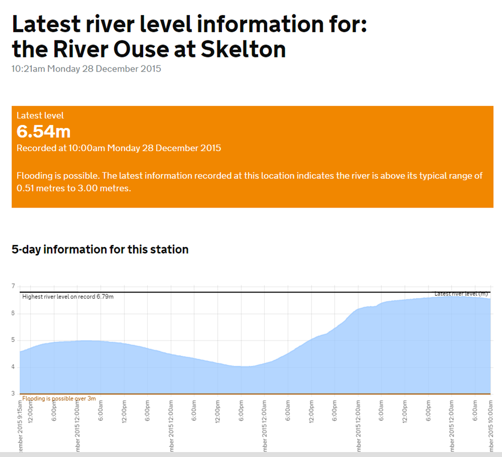
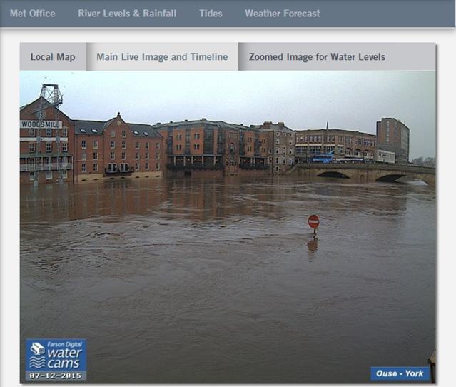
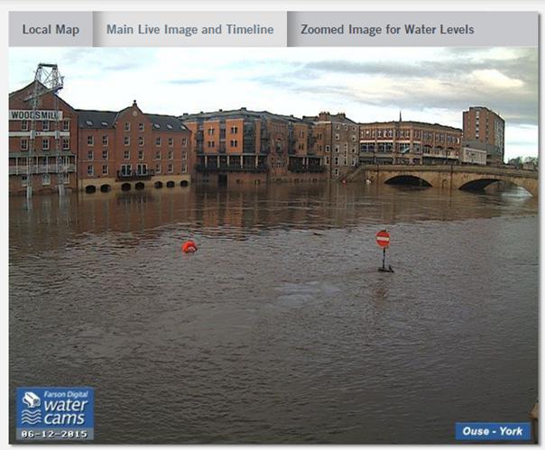
The river at Ouse Bridge has fallen to 4 metres above normal levels from its Sunday peak of 5.2m.
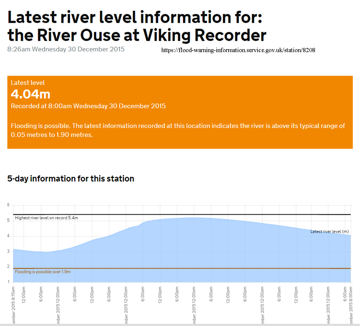
Ouse Bridge Viking gauge 0800 30th Dec 2015
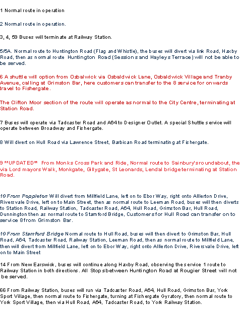
Most bus services are now operating their normal routes
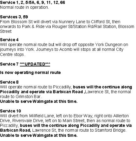
Bus Services 30th Dec 2015
The Council is providing “clean up” skips in streets affected by flooding
Temporary skips for flood damaged items
You can find skips for flood damaged items in the following locations:
- Tower St (x2) – inside lane opposite the tower
- Museum gardens entrance – Museum St
- Kings Staith
- Piccadilly (x2) – Pay and Display Bays
- Merchantgate (x2) – outside Red Lion
- Fossgate at Bridge (x2)
- Navigation Road (x4) – in resident parking bays
- Skeldergate – near cock and bottle
- Rosemary court (x5) – area in resident parking bays
- Lower Friargate – in parking bays
- Peckitt Street (x2) – in parking bays
- Walmgate (x3) – in Pay and Display bays
- Huntington Road (x3) – in resident parking bays near roundabout
- Huntington Road – near bridge
- Dennison St (x2) – in parking bays
- Gladstone St (x2) – in parking bays
- Yearsley Crescent
- Haley’s Terrace York – in parking bays
- Somerset Road – on verge
- River Street
- Colenso St – in parking bays
- Lower Darnborough Street – in parking bays
- Main Street, Acaster Malbis
- Marlborough Grove
- Elvington Main Street
More at https://www.york.gov.uk/flood