Carrfield snicket cycle barriers to be repainted

A bit of good news, the Council has agreed to repaint the cycle barriers on the Teal Drive to Carrfield snicket
Cycle barriers Teal Drive Carrfield snicket

Cycle barriers Teal Drive Carrfield snicket

Also good to report that the graffiti has been removed from the North Street flood gates
Graffiti now removed from second set of flood gates on North Street

Graffiti now removed from second set of flood gates on North Street

All the flood gates have been closed as a precaution today
Flood barriers closed 1130 Tanners moat 1130 10th Nov 2015 Ouse breaks banks 1130 10th Nov 2015

Flooding risks in York

Kings Staithe web cam click to update

Kings Staith web cam click to update

It’s that time of year again and a flood warning has been issued by the Environment Agency.
River levels are not expected to increase to those seen in 2012.
Detailed river levels can be found on the EA web site http://tinyurl.com/Ouse-catchment
The best indicator remains the real time CCTV camera which records river levels on Kings Staith (above).
There is a significant risk if the top of the “no entry” sign disappears under water!
You can register to receive flooding alerts by clicking here (phone text or Email)


Flooding warning in York

A flood warning has been issued by the Environment Agency. River levels are not expected to increase to those encountered in 2012.

Click for access (commercial web site with advert)

Click for access (commercial web site with advert)

River Ouse web cam Click to access latest information

The best indicator remains the real time CCTV camera which records river levels on Kings Staith.

Click to access Environment Agency monitoring station data (central York)

Click to access Environment Agency monitoring station data (central York)

There is a significant risk If the top of the no entry sign disappears under water!

Detailed river levels can be found on the EA web site http://tinyurl.com/Ouse-catchment

You can register here to receive flood warnings by phone, text or email.

Have your say on York’s Flood Risk Management Strategy

York floods Sept 2012 bar walls

Working with key partners including the Environment Agency and Yorkshire Water, City of York Council has created a draft Local Flood Risk Management strategy which will go out to a six-week consultation from Wednesday 5 November until Wednesday 17 December at www.york.gov.uk/consultations

A consultation questionnaire is available to complete online from this week. Alternatively, paper copies are available from libraries and Explore Centres across York, or the council’s West Offices building. Feedback can also be submitted to FRM@york.gov.uk .

To read the full strategy, FAQs and an information leaflet visit: www.york.gov.uk/floodriskstrategy

The development of the strategy follows severe floods in 2007 across the UK, including York, which affected over 55,000 homes and businesses causing over £3billion worth of damage across the UK.

(more…)

Dozens of streets in York have collapsed drains

Extent of repair backlog in York revealedKWW junction Windsor Garth 1

At least 55 streets in York have gulleys which are permanently blocked. The blockages mean that heavy rain is likely to result in extensive ponding and in some cases flooding.

The Council has responded to a Freedom of information request and revealed the list of streets which will be “dug out” this year. (see below)

The Council claims only to have 6 outstanding complaints about long term blocked drains.

However it has received 459 complaints about blocked drains during the last 18 months taking an average of 5.5 days to have the gulleys emptied.

The Council has been criticised for stopping the routine cleaning of most gulleys in the City. Instead they now respond only to complaints.

Heavy rain last month resulted in considerable flooding on highways and footpaths cross the City. It seems that many of the problem areas may not have yet been added to the Councils list of outstanding work.

The list of locations receiving significant engineering attention this year include:

  1. Ten Thorn Lane
  2. Back Lane
  3. Shipton Road (inside outer Ring Road)
  4. A1237
  5. School Lane
  6. Wetherby Road
  7. Field Lane
  8. Windsor Drive
  9. Hull Road
  10. York Road
  11. Bishopthorpe Road
  12. Wigginton Road
  13. Top Lane
  14. A1237 (Millfield roundabout)
  15. Wetherby Road
  16. Main Street
  17. Weldrake Lane
  18. Karelia and Ashdale Crossing
  19. Long Lane, Heslington
  20. Vicarage Lane
  21. Cow Moor Bridge
  22. The Village, Stockton on Forest
  23. The Village, Strensall
  24. Cleveland Way
  25. Bad Bargain Lane
  26. Moor Lane
  27. Lords Moor Lane
  28. Naburn Lane
  29. Elvington Lane
  30. Grantham Drive
  31. Welland Rise
  32. Beckfield Lane
  33. A1237, Rawcliffe
  34. Hurricane Way
  35. Sitwell Grove
  36. Huntington Road
  37. Front Street
  38. Bishopthorpe Road
  39. Haxby Road
  40. Gray Street
  41. Dauby Lane
  42. School Lane
  43. Malton Road
  44. Shipton Road
  45. Sheriff Hutton Road
  46. Strensall Road
  47. Mill Lane
  48. Corner Close

Call for York Council to publish information on blocked drains

Freedom of information request lodged

Woodthorpe Shops

Woodthorpe Shops

Following a couple of weeks of heavy rain problems with the City’s drainage systems have become more obvious. While most publicity has centred on roadside gullies, the lack of regular cleaning of channels in pedestrian areas, on footpaths and in car parks is also a concern.

Bracken Road

Bracken Road

Bracken Road

Bracken Road

North Lane

North Lane

North Lane

North Lane

As we reported earlier this month, the Council has discontinued the routine “emptying” of gullies. They rely on residents to report blockages. In turn, this depends on the Councils – sometimes creaking – customer contact systems.

As the photos show, even after the rains stops, it takes too long for some areas to drain.

Several problems were reported by Liberal Democrat campaigner Stephen Fenton (pictured) yesterday.

The Council has in the past taken some action to alleviate longer term problems. The then LibDem led Council introduced almost a decade ago a programme aimed at dealing with blocked drainage pipes.

In some cases this meant digging out compacted earth while in others concrete run off had blocked some drains. Some roads had to be re-profiled to provide a better run off.  Yorkshire Water – who are responsible for sewers – occasionally have to power wash out their systems, with carelessly discarded cooking fat often blamed for blockages

There has been a move away from non permeable surfaces with new parking areas on many estates now using a matrix style surface to allow natural soak away.

There have been no reports on the quality of drainage systems made to Council committees recently.  Quality of service data is hard to come by.

A Freedom of information request has now been submitted to the Council asking about the number of outstanding drainage complaints and the number of known long term blocked gulleys where significant engineering work is required to remedy the problem.

The Council is being asked how much it will cost to clear blocked gulleys and the timetable for so doing.

The Council has 28 days in which to respond to the information request.


Gulley cleaning halved by York Council

Gulley cleaning

Labour run York Council has confirmed that it has reduced by nearly half the number of times that drainage gulleys are cleaned in the City.

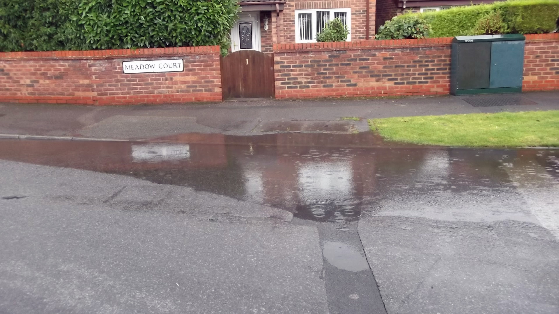
In 2010/11, the last year of Liberal Democrat control of the council, there were 38,000 gulley cleans. In 2013/14, after cuts by Labour in 2012, this was reduced to 20,664. The reduction has been blamed for increasing problems with so-called ponding and minor flooding on some local streets. Labour has cut the budget for gulley cleaning by £100,000 or 40% since coming to power, and reduced frontline staff.

Cllr Ann Reid, Liberal Democrat Spokesperson for Environmental Services who challenged the Labour Cabinet Member responsible at July’s meeting of York’s Full Council, commented:

“The halving of gulley cleaning is another example of Labour’s cuts to basic frontline services in York. The issue is not glamorous and there are few photo opportunities in it for Labour councillors, but it is a basic council service which matters to local residents.

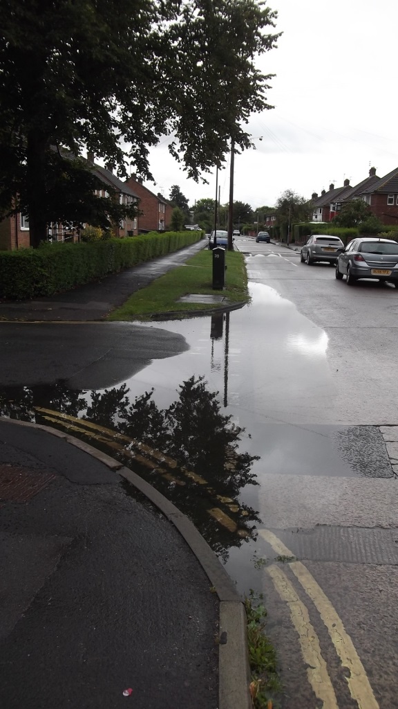
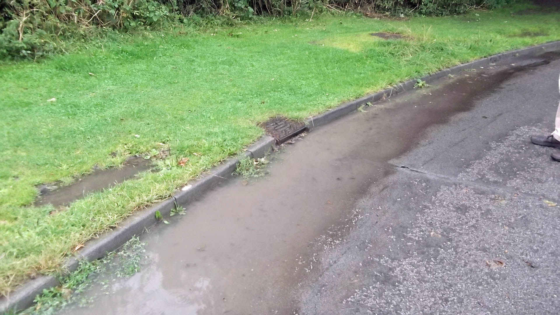
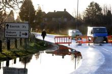
“I know last autumn and winter particularly there were incidents of flooding on local roads as water was not draining away properly. Regular cleaning of the road gullies helps stop this by ensuring that they efficiently drain water off the road surface and minimise the pressure on the drains. This is not happening due to Labour’s cuts.

“Labour should stop wasting money on city-centre vanity projects and restore funding to basic services for residents like street and gulley cleaning, grass cutting, litter bins and tackling potholes.”

NB Problems caused by inadequate gulley cleaning have been blamed for issues across York, including in Fulford last September when a blocked drain outside the ‘Sir John Hunt Memorial Homes’ caused considerable disruption. Please find attached a photo of Fulford Councillor Keith Aspden at the scene.

Cllr Reid asked the following question at July’s Full Council:

(xxii) To the Cabinet Member for Environmental Services, Planning and Sustainability from Cllr Reid:

“How many Full Time Equivalent (FTE) staff did the council have working on gulley cleaning in each of the last 4 years, how many vehicles are used for this purpose, and how many and what proportion of gullies were/are routinely cleaned in each year since 2010?”

Answer:

·         2010-2011, 4 no  FTE, approx 38000 scheduled gully cleans

·         2011-2012, 4 no  FTE, approx 39000 scheduled gully cleans

·         2012-2013, 4 no FTE, approx 20664 scheduled gully cleans

·         2013 -2014, 2 no FTE on 8 + 8 hour shift system rotation, approx 20664 scheduled gully cleans

Flooding in York – Dredge the Ouse?

River Ouse web cam Click to access latest information River Ouse web cam Click to access latest information

A flood warning has been issued by the Environment Agency. River levels are not expected to increase to those encountered in 2012.

Detailed river levels can be found on the EA web site http://tinyurl.com/Ouse-catchment

The best indicator remains the real time CCTV camera which records river levels on Kings Staith.

There is a significant risk If the top of the no entry sign disappears under water!

The devastation caused by flooding in other parts of the country is likely to reopen the debate about whether the river Ouse should be dredged.

Although dredging might increase the river capacity (and speed) where the work could be completed there would be other implications. Not least amongst these are the fact that more water would arrive in greater volumes at vulnerable downstream locations.

Potentially this could mean more, rather than fewer, homes being flooded. There are also concerns about the impact that dredging can have on the foundations of bridges. on river banks and on wildlife habitats.

The policy introduced a few years ago – of planting near the upper reaches of rivers to help control the speed that water runs off the land – has merit, while the York Council is rightly making provision, in its forward budgets, for the improvement and maintenance of water courses.

Nevertheless the dredging arguments do now need to be revisited and we would like to see a committee set up to publicly consider all the issues involved.

Coalition government acts to prevent A19 flooding near Fulford.

The coalition government has allocated millions in funding towards improving one of York’s key arterial routes. It will pay for much needed flood prevention works, new signalisation and improved access at key junctions on the A19 near Fulford.

A19 closed near Fulford last winter

A19 closed near Fulford last winter

The £170 million government Pinch Point Funding was announced earlier this year and part of it is to be used to protect the A19 from any future closure, following an unusual series of flood incidents in 2012 which resulted in the main road closing on three separate occasions. In comparison to a total of five days over the previous four years.

York will receive approximately £2 million from the Department for Transport towards the cost of the £4.7m project which will help towards supporting local transport schemes that tackle congestion and support growth.

The remaining funding will be provided from the private sector and existing council transport budgets.

Key elements of the proposals are to introduce a new left turn free flow lane from A19 into the Designer Outlet Park&Ride; inbound bus priority lanes on the A19 between A64 and Germany Beck, and bus priorities at the Naburn Lane junction and an enhanced junction at the proposed Germany Beck development.

The scheme will complement and enhance the improvements planned to be provided as part of the Germany Beck development, which will create new access to the site and raise the height of the road to be above flood levels.

There will be consultation on the proposed scheme details and the aim is to start construction towards the end of 2014.