Following the recent consultation on outline proposals to support cycling, walking and bus use along the Tadcaster Road corridor, City of York Council officers have reviewed the feedback and have proposed a set of revised proposals, which will be discussed at a public Decision Session on Tuesday 19th October.
Local councillors held some drop-in sessions in September to give residents an opportunity to view the £1.4 million proposals, which are funded from the West Yorkshire Combined Authority’s Transforming Cities Fund and are to be delivered as part of a wider package of measures funded by the Department for Transport’s Local Highways Maintenance Challenge Fund. Feedback from these drop-in sessions was fed in as part of the consultation.
Drop-in session held at Little Hob Moor on 18 September
The report for the Decision Session notes that a significant number of respondents were not in favour of some of the interventions intended to improve conditions for pedestrians, cyclists and bus passengers (especially the new signalised crossings), but many respondents felt that the provision for cyclists, pedestrians and bus passengers did not go nearly far enough. A number of alternative schemes were proposed, or alternative uses of the funding, including suggestions that all of the funding should be allocated to a single intervention, such as substantial modifications to Moor Lane roundabout to improve it for cyclists.
The report notes that a ‘lesson learned’ from the consultation is the need to prioritise funding to make the greatest possible overall benefit, but accepting that, at current funding levels, schemes which comply with every aspect of LTN 1/20 (Government guidance on cycle infrastructure design) may not always be possible.
Set out below are some of the recommended revisions to the initial proposals:
The proposal to widen the footpath from the Tyburn to the Marriott Hotel to create an off-road shared cycle / foot path has been abandoned. This seems to be in response to opposition to a shared cycle / foot path such as that proposed. The report states that creating an off-road path that would be wide enough to accommodate segregation would require the felling of 12 mature trees
It is proposed to explore options for ‘light segregation’ to give cyclists in the on-road cycle lane some protection
Proposed footpath widening near The Horseshoe has been dropped after residents queried the necessity for this
In response to overwhelming opposition to the proposal to relocate the bus stop from outside the Slingsby Grove shops 75 metres south, officers will look for an alternative location (hopefully in consultation with councillors, businesses and residents)
For the proposed off-road cycle lane section opposite the Slingsby Grove shops, local councillors fed back the suggestion that rather than install a new cycle path behind the layby (which more confident cyclists wouldn’t use), could the layby be moved into that area to create a ‘buffer’ to enable cyclists to continue along the road without fear of being ‘doored’. This doesn’t appear to have been considered.
Whilst there isn’t currently the money available for a major project at the Moor Lane roundabout, the report talks about options to widen the two-way cycle paths around the roundabout (many of which are very narrow) by possibly reducing the lanes on the approach roads from dual to single. This did not form part of the consultation, and it is unclear what assessment has been made of the impact of such a proposal, for example on bus reliability (which is meant to be a key aim of the overall scheme). There are concerns in particular about the possible impact that such a proposal could have on the reliability of the number 12 service during peak times, as it has to navigate the roundabout on its journeys to and from Woodthorpe.
Moor Lane approach to the Askham Bar roundabout
The report confirms that a feasibility study has been completed which considers subway options at the crossing point between York College and Tesco. A viable layout has been developed but not progressed due to an estimated cost of £1.5 million which is beyond what is available and would not fit with the funding conditions. A subway option would also be subject to land take and further design, assessment and consultation as part of a later phase of work.
Northern Gas Networks, the gas distributor for the North of England, is carrying out further work on Tadcaster Road to replace ageing metal gas mains with new, more durable plastic pipes. Work starts on Monday 18th October and is expected to last for eight weeks.
So that engineers can carry out the work safely, and to protect the public, some traffic management measures will be put in place. From 18th October, temporary traffic lights will be in place on Tadcaster Road for approximately four weeks. These will start at the junction with Slingsby Grove and move in sections to finish near the junction with Middlethorpe Drive. There will also be excavation work on The Horseshoe and Old Moor Lane.
Signs will be displayed for motorists and shops and businesses in the area will remain open as usual while the work is underway.
The gas works will be carried out on the inbound carriageway only. As these works will affect 50% of the road that was resurfaced in summer 2020, the affected section will be resurfaced again by recycling the material on site as part of a £5m package of Government-funded improvements to drainage, lighting, footpaths and road surfaces along the Tadcaster Road corridor.
The council was not made aware of the need for major gas works before the resurfacing work that took place in summer 2020.
Two storey extension to front and rear with render finish, single storey rear extension and rear canopy, replacement dormers to front and rear and new roof covering
On Saturday 18 September Dringhouses & Woodthorpe ward councillors held two drop-in sessions for residents to have their say about proposed cycle, walking and bus improvements along the Tadcaster Road corridor, as part of a consultation which closed on 19 September.
Ward councillors were also joined by a member of the council’s iTravel team
The morning session was held on Little Hob Moor and the afternoon session on Hunters Way. Set out below is the feedback received from residents who wrote their comments on post-it notes and stuck them onto the relevant maps.
A1 – The Mount near Dalton Terrace
Afternoon session:
Priority for cyclists at outbound junctions with Mill Mount Court and Mill Mount
The current off-road provision outbound is difficult to use, many cyclists use the road
A2 – Mount Vale to near Knavesmire Road
Morning session:
Existing segregated cycle / foot path should be retained in its current layout – don’t remove the white line
All pedestrian crossings should be on raised platforms to slow traffic
Concern that having too many crossing points will worsen traffic congestion and air pollution, which affects cyclists and pedestrians
Oppose removal of Trentholme Drive filter lane
Removal of sections of bus lane on The Mount is pointless and unsafe
Oppose loss of central areas which provide safe space for right-turning cyclists
Please add traffic lights back to the bus lane at the top of The Mount as congestion is awful with taxis rather than buses halting traffic
Need yellow lines on Knavesmire Road
Afternoon session:
Protected cycle lane needed inbound from St Georges Place
A3 – Tadcaster Road near Pulleyn Drive
Morning session:
For Pulleyn Drive, and for Nelsons Lane, please reinstate the central area for outbound right-turning cyclists – move kerbs back to allow
Cycle path from Knavesmire Road outbound should be two-way
Need to educate road-users on why the changes have been made and the benefits
Clear signage to indicate where paths are shared use
All good for me
Afternoon session:
Fill in potholes in existing cycle paths
Keep cycle lane around the corner from Knavesmire Road onto Tadcaster Road
Why not create an off-road cycle path on the inbound side of the road?
Happy with shared used proposal, just like Sustrans routes which are shared with no markings
No segregation will put pedestrians at risk from ‘racing’ cyclists
Could northbound and southbound cyclists be segregated?
A4 – Tadcaster Road near Nelsons Lane
Morning session:
Will proposed new pedestrian crossing be a toucan?
Need right-turn box for outbound cyclists turning into Nelsons Lane
Maintain cycle /pedestrian segregation markings on ‘shared’ path
Not enough space for two-way cycle and walking
Nelsons Lane crossing is a great idea
Refresh off-road cycle markings
Afternoon session:
Will there be access points onto the proposed extended shared cycle / foot path for cyclists joining from the streets opposite, eg Chalfonts, Nelsons Lane
Will the new shared path be two-way for cyclists?
Could the new path be for cyclists only?
Pavements could be made more fit for purpose by cutting back vegetation
A5 – Tadcaster Road near St Helens Road
Morning session:
Move bus stop on St Helens Road further away from the junction
‘Bypass’ for bikes outside St Edwards church for bikes to continue outbound when lights on red?
Need decent-width off-road cycle lane all the way along the route. Inconsistent, patchy cycle route will not tempt drivers to cycle
Afternoon session:
Pedestrians and cyclists need to be segregated on the proposed new path from the Tyburn to the Marriott
Widening the footway will encroach onto the Knavesmire. Has this been discussed and agreed with the council’s Ecology team? Does it set a precedent? The land on the other side of the fence drops down quite a bit – has this been factored in, eg have civil engineers been consulted?
Microprocessor Optimised Vehicle Actuation (MOVA) at the St Helens Road junction will cause more traffic hold-ups
A6 – Tadcaster Road near Slingsby Grove
Morning session:
At Royal Chase junction need central space for right-turning cyclists
Moving the bus stop would mean access to driveways at 96 & 98 Tadcaster Road would be blocked
Encourage school families to use the St Helens Road crossing rather than the refuge near the Fox & Roman pub
Afternoon session:
Multiple residents very unhappy about the proposal to relocate the bus stop to the end of their driveways (these driveways serve 3 or 4 houses set back from the road)
Proposed new bus stop location would be too near to the existing bus stop at the end of The Horseshoe
The bus stop in its current location is well-used by residents of the Royal Chase estate – leave it where it is
Need to think strategically about bus stop and pedestrian crossing locations in this area. Is this stop needed? Could it be relocated further up, eg nearer the library?
Suggestion of a cycle lane inside the parking bays at the shops and the library
Why remove the trees?
What happens to the (Grade II listed) Pinfold?
The proposed short stretch of off-road cycle path behind the parking layby on the east side of Tadcaster Road will destroy green space
Support for the proposed cycle path behind the layby, will make it safer for cyclists
Whatever the outcome with the bus stop, the build-out at the junction with Slingsby Grove needs to be extended to push parking away from that junction and improve sight lines for motorists turning right out of Slingsby Grove
Layby and bus stop in front of the shops is a death trap – do we need a stop here so close to the stop at The Horseshoe?
Take bike path onto the pavement inbound – enough room for a segregated path
Introduce 2-hour parking limit outside shops
A7 – Tadcaster Road near The Horseshoe
Morning session:
Oppose removing central / hatching – safe space for right-turning cyclists
Retain verge width
Tree roots make pavement uneven near here
Do we need a new signalised crossing here? Maybe consider a zebra crossing or perhaps a refuge
Consider 20mph limit
Afternoon session:
Divert footpath away from the road at the Hunters Way junction to improve sight lines for motorists and cyclists pulling out onto Tadcaster Road
A signalised crossing here will help pedestrians and also reduce traffic speeds
A signalised crossing is not required here, will lead to more stationary traffic. A refuge is fine. What are the footfall stats in support of a signalised crossing?
The footpath width is fine as it is
Don’t remove right-turn filter lane for Middlethorpe Grove – useful for cyclists as well as motorists
Cyclists don’t just cycle in and out of town – they cycle into and out of streets off, and this needs to be factored into the thinking
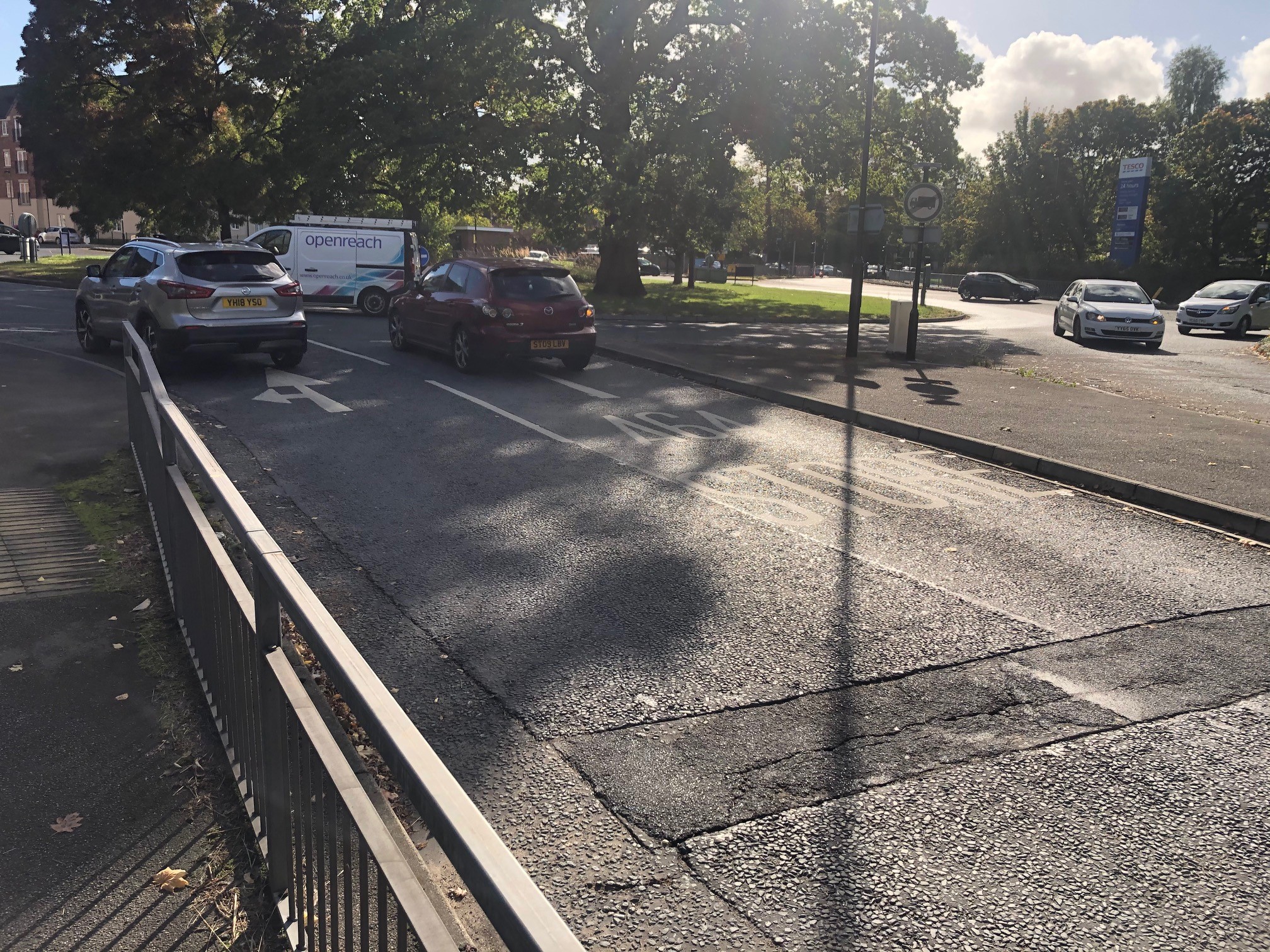
A8 – Tadcaster Road near Moor Lane roundabout
Morning session:
An option to stay on the road for cyclists should be included and visible to drivers as not all cyclists will want to use the path
Are the proposed changes to the footpath / cycle path arrangements between the Moor Lane roundabout and York College really needed?
Move the Old Moor Lane bus stop further up Tadcaster Road
Other parts of the city would benefit more from cycling infrastructure improvements
Need to widen the segregated cycle path where Moor Lane turns left onto Tadcaster Road – blind corner and overhanging hedge
Do we need to remove trees from the verge in the area around the bus stop opposite York College?
Afternoon session:
Direct students to use the pedestrian crossing near to Yorkcraft, rather than the crossing at the College
More significant intervention needed at the Moor Lane roundabout to improve traffic flow and in particular to support better bus reliability
A9 – Tadcaster Road near York College
Morning session:
Support for widening shared cycle / foot path at ‘cemetery corner’
An underpass (or footbridge) for York College should be a priority. Could the existing underpass to the solar system cycle path be adapted / extended?
Could cycles use the Park & Ride road through to Tesco?
Could the Park & Ride site become a bus interchange, which would allow the bus stops on that section of Tadcaster Road to be removed
Need hatching on Tadcaster Road at the top of Sim Balk Lane to stop people coming from the A64 blocking the road
This is just an enhanced version of the current poor layout
How about a two-way off-road cycle lane on the racecourse side?
The scheme continues to put cars first
Afternoon session:
If trees are to be removed, new trees should be planted
Put the existing pedestrian crossing at York College on a speed table and make that area a 20mph zone
Ask Tesco to set up a small shop on the campus site to help reduce the footfall across Tadcaster Road
Need a pedestrian crossing at the top of Sim Balk Lane – currently no provision there
Support proposal for bus layby opposite York College
Oppose proposal for bus layby as it will delay buses
Close the ramp leading down to Tesco
Comments not specific to specific elements of the scheme
More frequent bus services would encourage greater usage
Scheme needs to be designed by urban design specialists, not traffic engineers
Look at good examples elsewhere, eg Denmark, Netherlands
Need a city-wide strategy, reduce space for cars if necessary, and be brave
Action is needed to tackle cyclists who go through red lights or cycle on footpaths. A lot of anti-cycle sentiment (a fair bit of which we heard at the drop-in sessions) stems from the perception that many cyclists flout highway rules and endanger pedestrians with no consequences