‘Creative Arts Academy’ plan gets Government approval

The Ebor Academy Trust’s bid to establish a ‘Creative Arts Academy’ free school in York has been approved by Government, it was announced today.

When the Ebor Academy Trust announced its plans, it identified the council-owned former Askham Bar Park & Ride site as a possible location for the proposed new primary school, which would serve the whole city. In the recently-published Local Plan proposals, the council has earmarked that land for housing.

The Ebor Academy Trust say that they will now work closely with City of York Council to secure a site, and are aiming for a September 2017 opening.

Graffiti battle on Tadcaster Road

We have been able to arrange for two street cabinets on Tadcaster Road to be repainted after they were daubed with graffiti – a BT cabinet opposite the junction with Nelsons Lane and a Northern Power Networks box at the junction with Middlethorpe Grove.

Ashley Mason with the newly repainted Nothern Power Networks cabinet

Ashley Mason with the newly repainted Northern Power Networks cabinet


Freshly painted BT cabinet

Freshly painted BT cabinet


Sadly our local graffiti artist with the yellow pen has been at it again, this time attacking the traffic box opposite the junction with Middlethorpe Drive. We have asked the council to arrange for it to be repainted.

The latest bad art job

The latest bad art job

Moor Lane green belt plans challenged

The council recently set out its proposals for York’s Local Plan, which includes designating land off Moor Lane as green belt. Previous draft plans brought forward under the Labour administration had proposed building on this land, and then ‘safeguarding’ it for development.

At a meeting of the council’s Local Plan Working Group on 27th June, a speaker from HOW Planning put forward an alternative vision for the land off Moor Lane, which would see 1,250 houses built on the site.

A letter sent to members of the Local Plan Working Group by Northampton-based Barwood Development Securities Ltd is available here – Letter to LPWG members 270616, and their ‘vision document’ setting out their plans for the site, is available here – Moor Lane Vision Doc .

The document includes a map showing the extent of the land that Barwood propose to develop (copied below). The proposals cover a much larger area than was included in the previous draft plan as ‘safeguarded’ land.

Moor Lane site


Local councillor Ann Reid, who is a member of the Local Plan Working Group, said  “I do not support these proposals, and made that clear at last night’s meeting. Local residents who backed the campaign to protect the land off Moor Lane as green open space will be alarmed at what is being proposed here.”

“The consultation on the proposed Local Plan – which would see the land off Moor Lane protected from development – is likely to get underway in mid July. It is important that everyone who wants to see this area protected takes part in that consultation and makes their views known.”

Local Plan proposals published

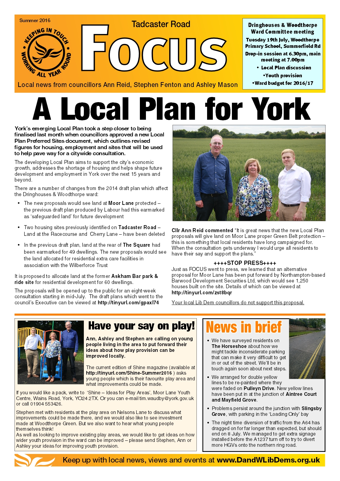
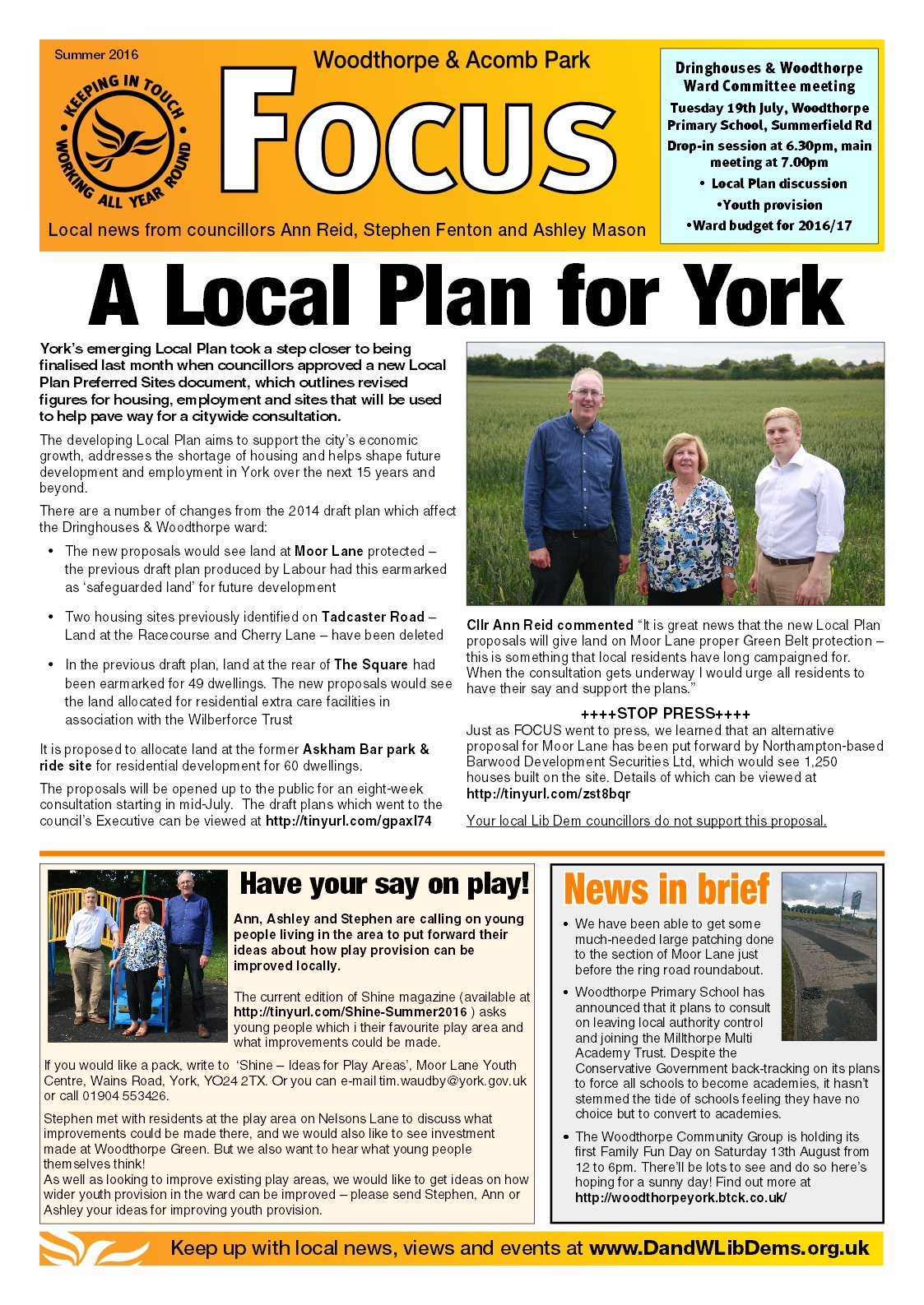
York’s emerging Local Plan will take a step closer to being finalised this month when councillors will be asked to approve a new Local Plan Preferred Sites document, which outlines revised figures for housing, employment and sites that will be used to help pave way for a citywide consultation.

local-plan-map


The developing Local Plan aims to support the city’s economic growth, addresses the shortage of housing and helps shape future development and employment in York over the next 15-years and beyond.

The draft plan includes a number of changes from the 2014 publication draft which affect the Dringhouses & Woodthorpe ward:

  • The proposals would see land at Moor Lane, Woodthorpe protected – the previous draft plan had this earmarked as ‘safeguarded land’ for future development
  • Two housing sites previously identified on Tadcaster Road – Land at the Racecourse and at Cherry Lane – have been deleted
  • In the previous draft plan, land at the rear of The Square had been earmarked for 49 dwellings. The new proposals would see the land allocated for residential extra care facilities in association with the Wilberforce Trust
  • It is proposed to allocate land at the former Askham Bar park & ride site for residential development for 60 dwellings

In line with the Government’s National Planning Policy Framework, introduced in 2012, a draft report will go before Executive on 30 June, following a meeting with the Local Plan Working Group on 27 June. If approved, the proposals will then be opened up to the public for an eight-week consultation starting in July.

Cllr Keith Aspden, Liberal Democrat Deputy Leader of City of York Council, said:

We have worked with officers since last May on these proposals which aim to deliver the housing York needs but protect the character setting of the city.

“I’m delighted that we are now moving forward to be in the best possible position to take the emerging Local Plan through to adoption. As part of this process, it’s essential that we engage with members of the public through consultation and this report provides important details on the upcoming Preferred Sites consultation, which we will launch this July.

“As the joint administration we have committed to engage with the York’s residents and businesses and this will be one of a series of stages where we will do this. As well as public exhibitions we are sending information to every household in York which will outline in detail the next steps between now and submission to Government next year.”

The Preferred Sites Document identifies approximately 480 hectares of land for housing and approximately 57 hectares of land for employment. The previous publication draft plan included approximately 960 hectares of land for housing and 61 hectares of land for employment.

The majority of the land removed sits within the draft Green Belt with proposed green field housing sites cut by over 50 per cent from 862 hectares to 366.

The vast majority of draft green belt sites proposed in 2014 have either been removed entirely, substantially altered and/or reduced in size.

In addition to this, the previous publication draft included 335 hectares of safeguarded land identified for longer term need. All safeguarded land has now been removed from the plan. A small element has been reallocated for employment uses at Grimston Bar and Northminster.

Proposed housing on brownfield land has increased from 85 hectares (in 2014) to 101 hectares, with York Central alone earmarked for 1,500 new homes.

These projections are in line with York’s independently-assessed housing need, taking account of completed sites, sites with permission and supplemented by small windfalls (sites which come forward during the plan period). Overall, the proposals will deliver land for at least 8,277 homes for the period up to 2032 and 2,450 homes for the period 2032 and 2037.

Linking housing and employment growth continues to be an important element of this work. Over 50 hectares of employment land has been identified for future development in York over the lifespan of the new plan, including the University of York, York Central and Northminster.

Significant evidence work was undertaken prior to the draft Preferred Sites paper to ensure York’s heritage and conservation, open spaces are protected and flood risk areas were taken into account.

The plan is expected to be submitted to the Secretary of State (Planning Inspectorate) by May 2017.

To view a copy of the Local Plan Working Group report visit: http://democracy.york.gov.uk/ieListDocuments.aspx?CId=128&MId=9703

To find out more visit www.york.gov.uk/localplan

Tacking street-level issues on Tadcaster Road

We are working to get action on a number of street-level issues in the Tadcaster Road area.

Graffiti has been cleaned off the Middlethorpe Grove Street sign at the junction with Tadcaster Road, and the electric utility company have been asked to clean up the graffiti that has been daubed on one of their cabinets on Tadcaster Road.

This graffiti has now been cleaned off

  This graffiti has now been cleaned off


Electric utility box

We have also managed to get the drainage channel outside the vets on Tadcaster Road repaired and cleared out – blockages have been causing the parking layby to flood.

Before....

Before….


...and after

…and after


We have obtained a new street sign for Middlethorpe Drive, as the old sign was badly faded.

Shiny new street sign

Shiny new street sign

Chapmans Pond re-opens for fishing

Chapmans Pond is set to re-open for fishing on Monday 13th June, having been closed for recent weeks to allow the fish to spawn.

The re-opening of the full site comes after a successful summer fair held by Love to East and the Friends of Chapmans Pond on Sunday 12th June.

Chapmans Pond fairVisitors to the fair enjoyed a BBQ and cake stall, as well as a range of stalls and exhibitors including West Thorpe scouts, Dringhouses Library and Holgate Windmill.

And thankfully the rain held off!

Traffic misery as A64 road works overrun

Highways England have admitted that the overnight closures of the A64 at the Bishopthorpe Bridge are set to continue into July, meaning further disruption for residents of Tadcaster Road as traffic is diverted off the A64 and through the city centre. Highways England had previously said that the works should be completed by the end of May.

A64 diversion sign


Complaints by residents about HGVs travelling at speed along Tadcaster Road through the night prompted Cllr Stephen Fenton to request information from Highways England on when the works would finish. Stephen was told that the slippage was due to “a number of reasons including the need for additional drilling works to fix the new barriers on the bridge.”

Stephen commented  “It is disappointing that the works are over-running, and that information about the slippage of the expected completion date wasn’t proactively communicated to residents or local councillors by Highways England.”

Through traffic on the A64 is meant to be diverted onto the A1237 northern ring road, but the signs on the A64 are very near to the turn off for the A1237. Stephen has asked for some signs to be installed back towards Tadcaster, to give HGVs and other through traffic more notice and reduce the likelihood of them all ending up on Tadcaster Road.

The photograph below was taken at 8.30pm on Friday 3rd June, showing traffic backed up on Tadcaster Road almost all the way back to the Askham Bar roundabout.

Tad Rd traffic