
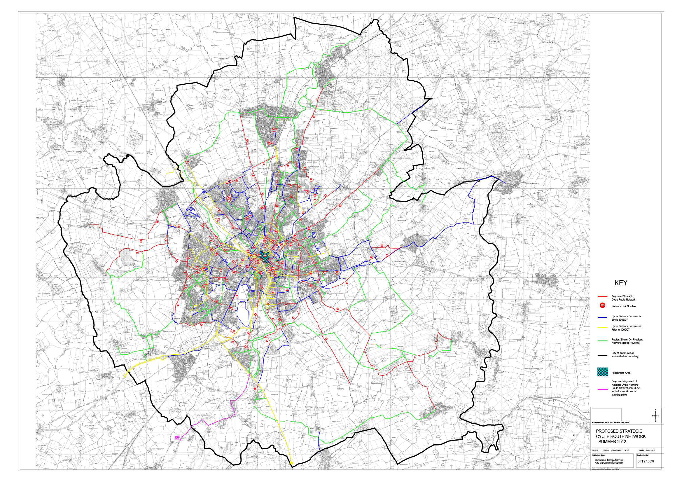
York cycle route map - click to enlarge
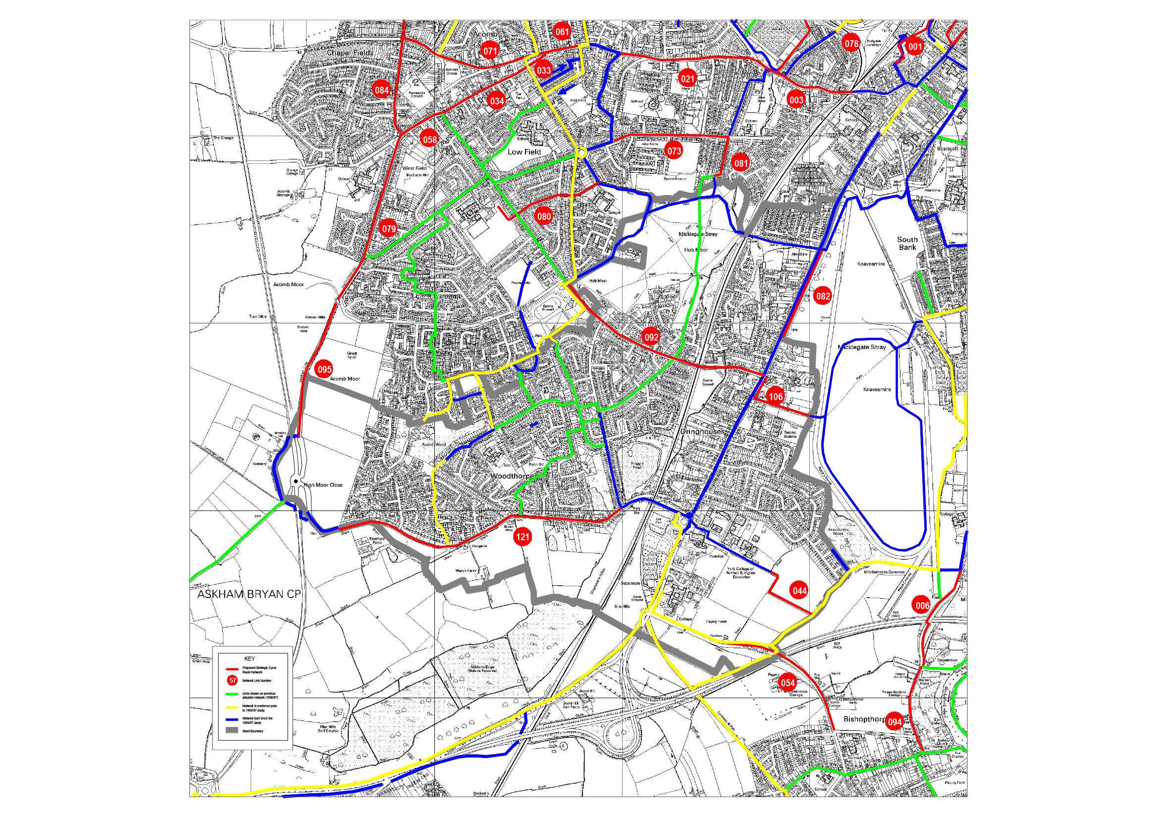
Dringhouses detailed cycle route map - click to enlarge
Local Councillors are being consulted on the Councils plans for enhancements to the strategic cycle network.
The proposals are reproduced here.
In brief the different coloured routes on the map represent the following:
Red routes – these are the ones which comprise the new proposed Strategic Network and those which have been prioritised on the spreadsheet.
Green Routes – these were included on the previous version of the strategic network (mid-90s) but are not proposed to be on the new one. (Sadly it appears that critical links between Woodthorpe/Acomb Park/Foxwood and Acomb are being jettisoned along with the Acomb to Askham Bryan college link).
Yellow routes – these are the routes which were already in existence when the previous strategic network was adopted in the 90s.
Blue routes – these are the routes which have been built since the first strategic network was adopted and together with the yellow ones form the current built network.
We understand that the Council will be publishing the maps on their web site for the general public to feed back their comments (its not there yet as far as we can see). Please copy us into any comments that you may make.
The closing date for getting comments back is 31st August to give as many people as possible the opportunity to comment even though this is the Summer holiday period.
Once the Council has all the comments back from members, Parish Councils and the public they will review them and amend the map and prioritised list of schemes as appropriate. “The resulting map will then be put forward for formal adoption as the council’s blueprint for future cycle route provision and will then influence future development control and transport capital programme decisions”.