
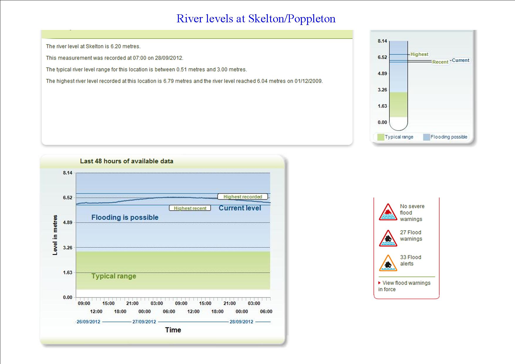
River levels on the Ouse at Poppleton. click to enlarge
The Ouse and Foss river levels are now subsiding but it will be a day or so before all roads reopen.
The river level graphs provided by the Environment Agency demonstrate just how severe the threat was yesterday with the monitoring stations at both the Foss barrier and that on the Ouse at Poppleton/Skelton recording record highs.
The performance of the Council in the Leeman Road area is now likely to come under scrutiny. Residents there are reported as saying that they felt “abandoned”. Similar sentiments were expressed in 2000.
The Achilles heel of the flood prevention system in that area seems to be backing up in the sewers. Residents will need to be convinced that the £3.2 million scheme to increase the height of the barriers, and which was announced in February, will also address the sewer/drainage issue.
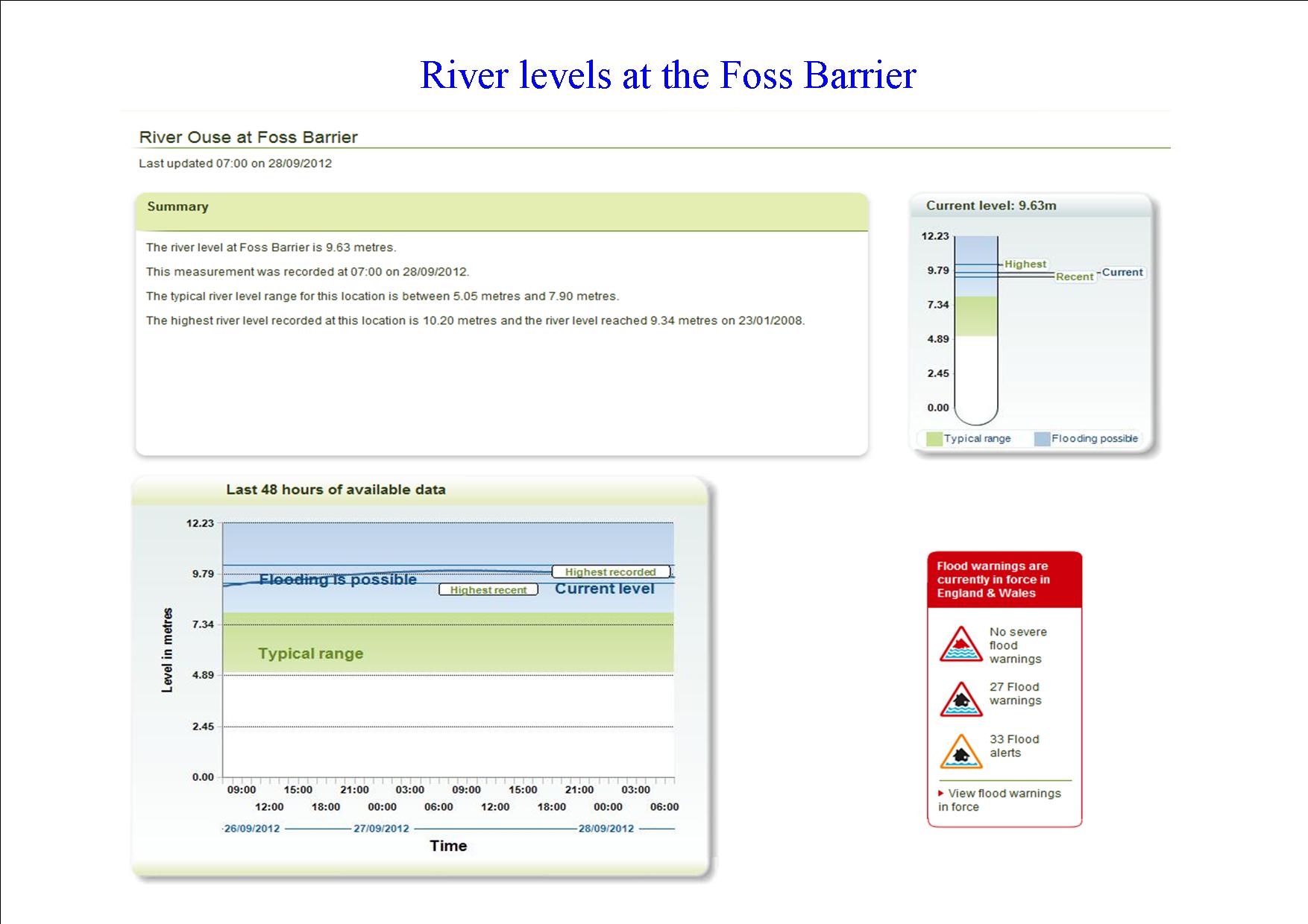
River levels at the Foss barrier. click to enlarge