
There is flooding in the Huntington/New Earswick area where the River Foss is 2.73 metres above normal levels. Huntington Road is closed at the railway bridge. Skeldergate is also closed.
Substantial rainfall is expected during today.
Currently other local rivers are below the peak that they reached in September. However, there are widespread flood warnings in place in the area.
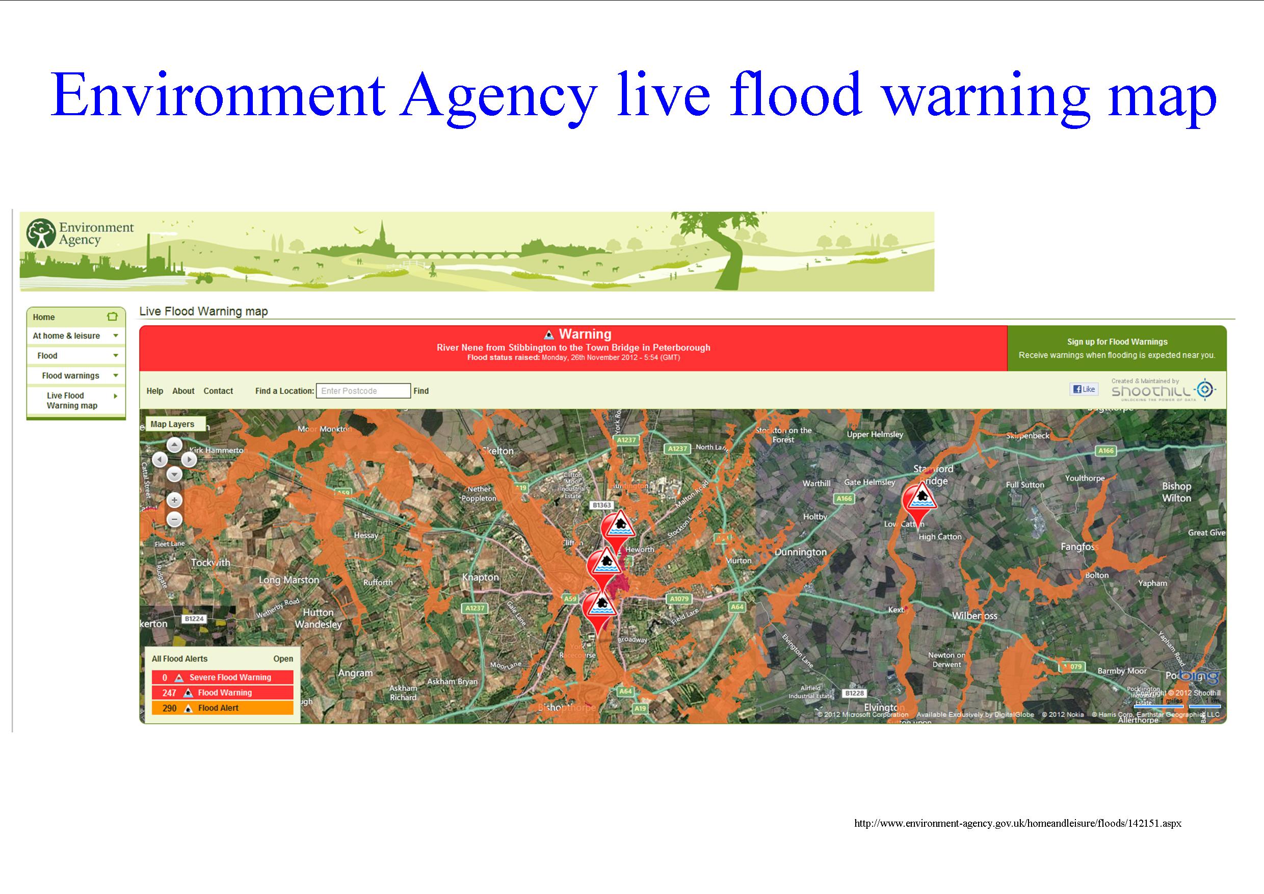
Click to enlarge
The Environment Agencies web site also now has an improved graphical representation of flood threats (above) It can be accessed here: http://www.environment-agency.gov.uk/homeandleisure/floods/142151.aspx
You can check the position at monitoring sites across the County here for the Ouse catchment area http://tinyurl.com/Ouse-catchment
You can register to receive flood warnings from the Environment Agency here https://fwd.environment-agency.gov.uk/app/olr/home
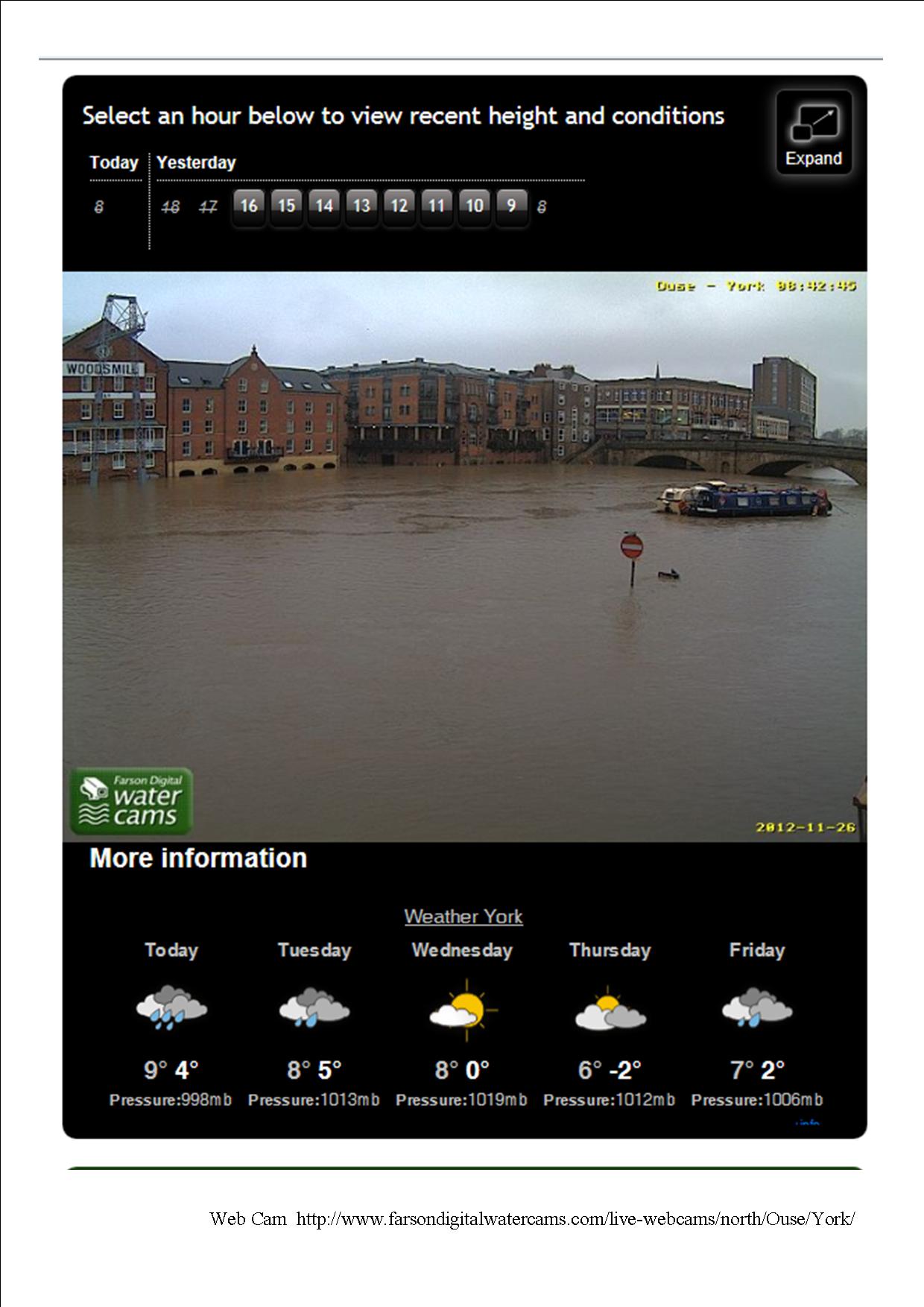
River Ouse web cam 09:00 26th Nov 2012 clcik to enlarge
Check out the current river level position on this Kings Staith web cam http://www.farsondigitalwatercams.com/live-webcams/north/Ouse/York/# As a rule of thumb, provided the no entry sign remains visible, there should only be relatively minor flooding in York.,
These are the direct links to the environment Agencies water level monitoring stations for York. They give the current river levels and compare them to historical records. Levels are all now in the area where some flooding is possible and the Agency is forecasting further rises in the levels later today.
http://tinyurl.com/Holgate-beck-level
http://tinyurl.com/York-City-centre-river-level
http://tinyurl.com/Foss-Barrier-river-level