Surprise at Sim Balk Lane development plans

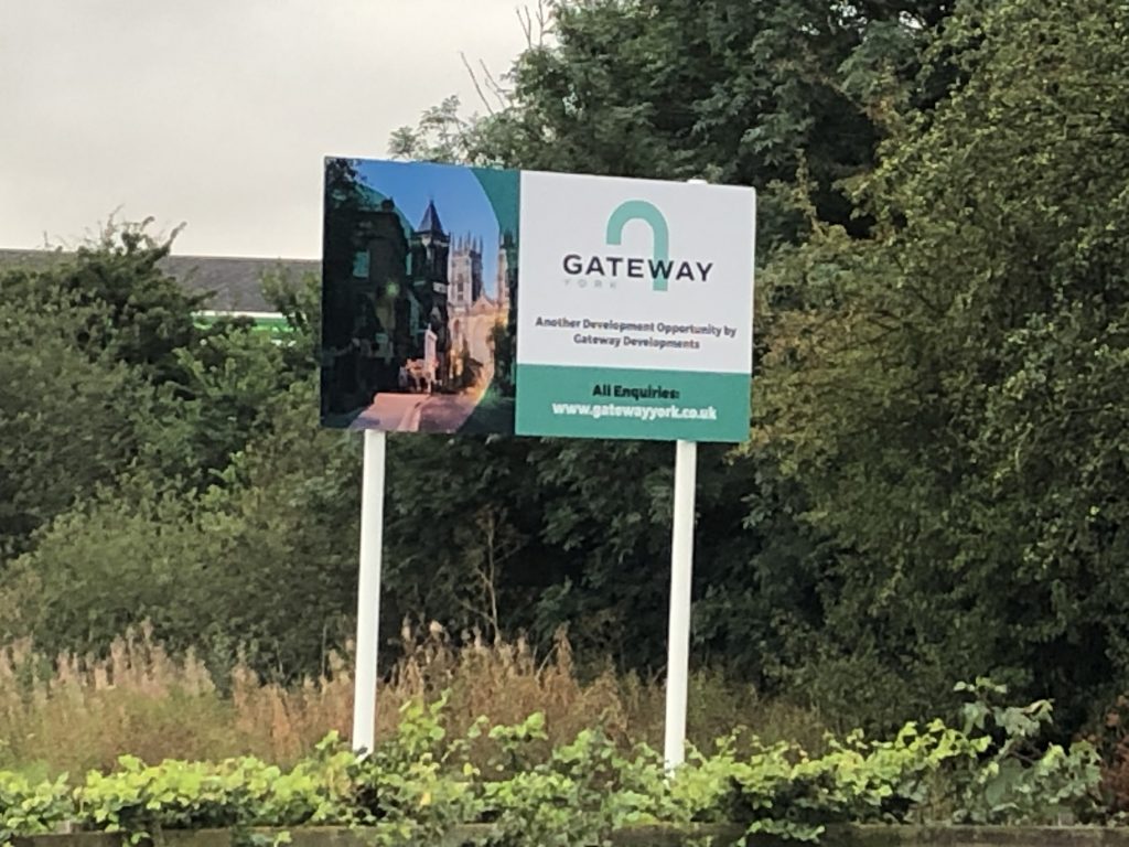
Local councillors and residents were taken by surprise when a poster board appeared at the junction of Sim Balk Lane and Tadcaster Road advertising “another development opportunity by Gateway Developments.”

The poster helpfully displays a web address – www.gatewayyork.co.uk

The website of the developers, Gateway, sets out an ambition to develop four sites – two in Dringhouses either side of Sim Balk Lane, and two in Bishopthorpe on Church Lane and Copmanthorpe Lane.

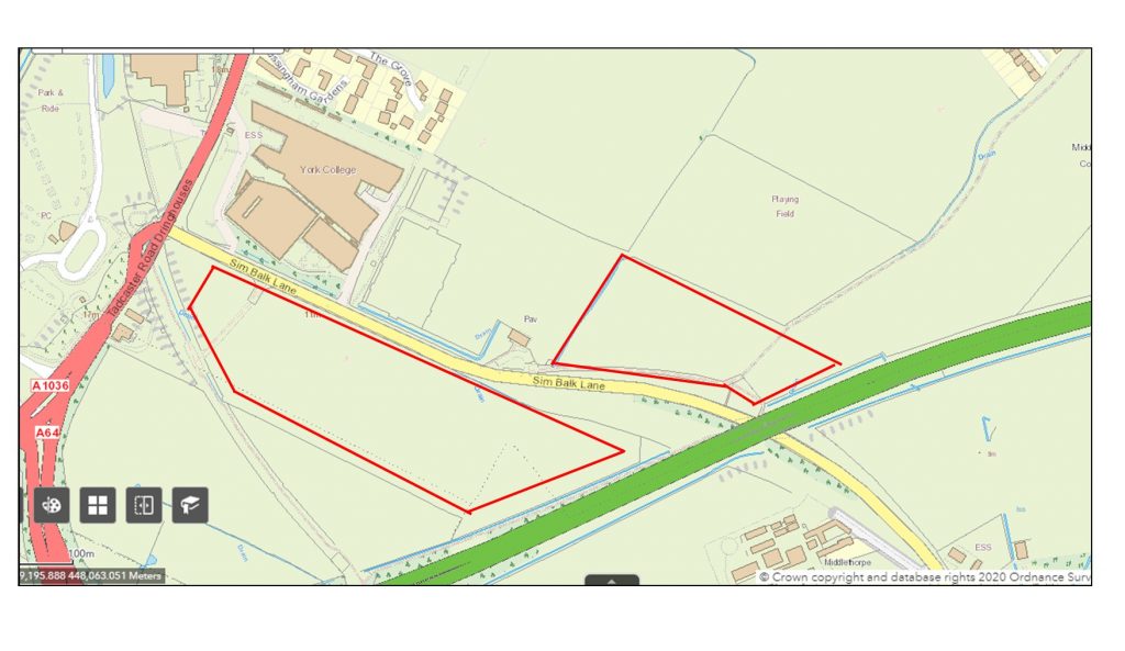
In Dringhouses, the developers have identified 25 hectares of Green Belt land either side of Sim Balk Lane, highlighted in red on the map below, which they claim is suitable for “mixed use development comprising of residential, care home, hotel and leisure.” Neither site is earmarked for development in York’s emerging Local Plan.

The developers envisage that these two sites could accommodate 247 new homes, or could lend themselves to a mixed-use development, claiming that “this site would offer a great opportunity for a hotel in close proximity of the sites next to the college, similarly providing scope and expansion of the college facilities.”

The developers state that “the site, due to its current land uses, does not have an effect upon the historic visual character of the city of York and will enhance the surrounding developed sites with employment opportunities and facilities.”

No mention is made of the impact that any development would have on an already congested highways network in this part of the city, or how these impacts might be mitigated.

Local councillors will update residents as and when we learn more about the developers’ plans.

New threat emerges to Moor Lane Green Belt

Dringhouses & Woodthorpe Lib Dem councillor Stephen Fenton has expressed concern at the submission of an application for a ‘scoping opinion’ on proposals to develop land off Moor Lane in Woodthorpe that has been earmarked as Green Belt.

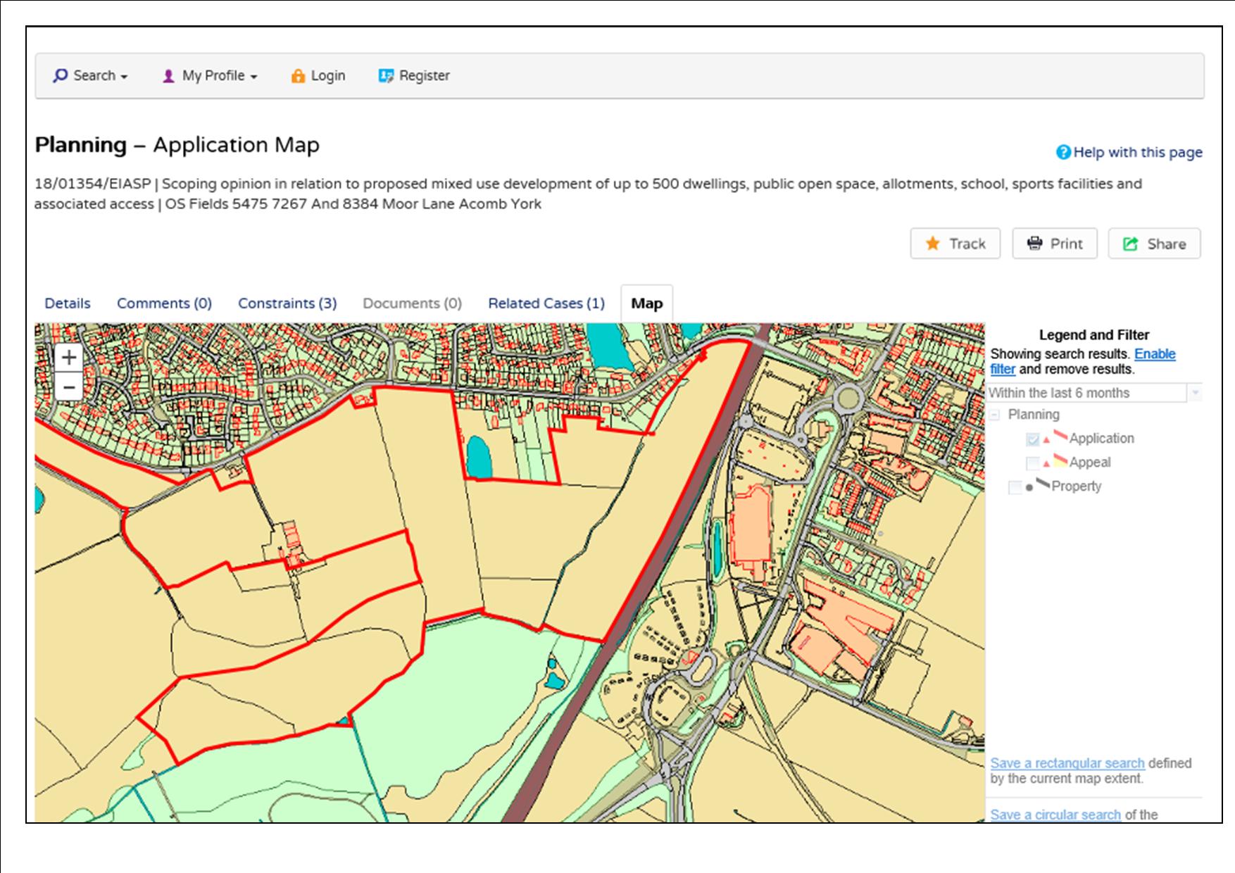
The application refers to plans to build 500 homes on land adjacent to the Askham Bog nature reserve, along with a school, sports facilities, allotments and public open space. It is believed to be a precursor to a more detailed planning application being submitted.

The red line marks the area for which an application has been made for a ‘scoping opinion’

Developers have previously set out their desire to develop the site, most recently in 2016 when they published a brochure setting out an aspiration to build 1,250 homes:

Moor Lane green belt plans challenged

Commenting on the new application, Cllr Fenton said “This application for land that has been earmarked as Green Belt is unwelcome, and will be resisted.

“Throughout the various stages of consultation on York’s Local Plan, residents and local councillors have been firm in their opposition to the development of this site, which is right next to the Askham Bog Site of Special Scientific Interest.”

Following the submission of York’s Local Plan to Government on 25 May 2018, Planning Inspectors have been appointed to conduct an examination as to whether the Plan is ‘sound.’

More consultation on Local Plan

Just when you thought that the Council had finally decided on a Local Plan that would take York into the 2030’s, the authority has launched another public consultation.

The last consultation  took place in the spring.

The Council says that”homes  in the city will receive a special edition of the Our City publication over the next two weeks, which explains the plan and how to have your say.

The full version of the Local Plan pre-publication draft – and comment forms which can be sent freepost –  is available to view online at www.york.gov.uk/localplan,  in all the city’s libraries and the council’s reception at west offices.

Residents are also invited to one of eight special consultation events, while additional information will also be available at all ward committees which meet during the consultation period.

You can also get involved via twitter @CityofYork or facebook.com/cityofyork, using the hashtag #YorkLocalPlan

There wil be a public consultation event on Monday 16 October at Acomb Explore Library, Acomb (3-7.30pm)

Additional information will also be provided at the ward committee meeting (Dringhouses & Woodthorpe joint with Westfield) – Tuesday 26 September  York & District Indoor Bowls Club, 302 Thanet Road, Dringhouses, York, YO24 2NW 6.30-8pm)

The published plans still involve development of the Lowfields playing field, so it is important that residents record their objections to any proposals that they disagree with

There is expect to be an “examination in public” by an independent inspector early next year.

Local Plan consultation – have your say before Monday!

The council’s consultation on the draft Local Plan close at 5pm on Monday 12 September. We would urge all residents to have their say on the proposals, and in particular to support the proposal to designate land off Moor Lane as green belt land protected from development.

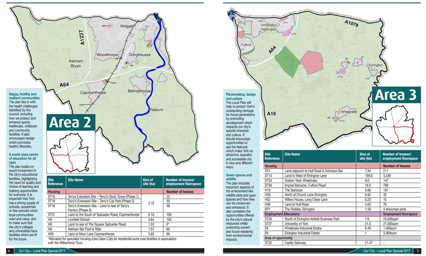
Extract from the 'Our City' newsletter

Extract from the ‘Our City’ newsletter


The Moor Lane site was referred to in previous drafts of the Local Plan as site ‘ST10’.

Information on how to take part can be found on the council website at http://york.gov.uk/localplan


Have your say on Moor Lane green belt proposal

In our recent FOCUS newsletter we set out details of the draft Local Plan for York that the joint administration has developed.

We are pleased that the draft plan, if approved, would see land off Moor Lane given proper Green Belt protection. This is great news, after the previous Labour administration in York proposed initially that the land be built on, and then said that it should be ‘safeguarded’ for future development.

Moor Lane field

So whilst we may have won this battle, we haven’t yet won the war. The draft Local Plan is now out for consultation, and if residents want to see the land off Moor Lane given Green Belt protection, they need to make your views known by responding to the consultation.

We now know that developers are fighting the proposed designation of this land as Green Belt – Barwood Development Securities Ltd are promoting an alternative plan that would see a staggering 1,250 homes built all the way from the railway line to the ring road roundabout. You can read more about these worrying proposals on at http://tinyurl.com/zst8bqr

This new threat makes it even more important that residents respond to the consultation to express support for the council’s draft Local Plan.

The consultation runs until 12th September, and there are lots of ways to take part:

  • You can go to www.york.gov.uk/localplan to view the Local Plan proposals and complete an online form
  • You can e-mail localplan@york.gov.uk
  • You can write to Freepost RTEG-TYYU-KLTZ, Local Plan, City of York Council, West Offices, Station Rise, York YO1 6GA
  • A special copy of the council’s ’Our City’ newsletter will also be arriving on doormats shortly, summarising the consultation information and providing a freepost response form

There will also be a drop-in exhibition at Tesco Askham Bar on Wednesday 24th August from 3pm to 7.30pm.

This consultation is about the draft Local Plan that the council is proposing, not about the Barwood proposals. It is vital that as individuals, and as a community, we express our support for the plan to give land off Moor Lane proper Green Belt protection.

Moor Lane green belt plans challenged

The council recently set out its proposals for York’s Local Plan, which includes designating land off Moor Lane as green belt. Previous draft plans brought forward under the Labour administration had proposed building on this land, and then ‘safeguarding’ it for development.

At a meeting of the council’s Local Plan Working Group on 27th June, a speaker from HOW Planning put forward an alternative vision for the land off Moor Lane, which would see 1,250 houses built on the site.

A letter sent to members of the Local Plan Working Group by Northampton-based Barwood Development Securities Ltd is available here – Letter to LPWG members 270616, and their ‘vision document’ setting out their plans for the site, is available here – Moor Lane Vision Doc .

The document includes a map showing the extent of the land that Barwood propose to develop (copied below). The proposals cover a much larger area than was included in the previous draft plan as ‘safeguarded’ land.

Moor Lane site


Local councillor Ann Reid, who is a member of the Local Plan Working Group, said  “I do not support these proposals, and made that clear at last night’s meeting. Local residents who backed the campaign to protect the land off Moor Lane as green open space will be alarmed at what is being proposed here.”

“The consultation on the proposed Local Plan – which would see the land off Moor Lane protected from development – is likely to get underway in mid July. It is important that everyone who wants to see this area protected takes part in that consultation and makes their views known.”

Local Plan proposals published

York’s emerging Local Plan will take a step closer to being finalised this month when councillors will be asked to approve a new Local Plan Preferred Sites document, which outlines revised figures for housing, employment and sites that will be used to help pave way for a citywide consultation.

local-plan-map


The developing Local Plan aims to support the city’s economic growth, addresses the shortage of housing and helps shape future development and employment in York over the next 15-years and beyond.

The draft plan includes a number of changes from the 2014 publication draft which affect the Dringhouses & Woodthorpe ward:

  • The proposals would see land at Moor Lane, Woodthorpe protected – the previous draft plan had this earmarked as ‘safeguarded land’ for future development
  • Two housing sites previously identified on Tadcaster Road – Land at the Racecourse and at Cherry Lane – have been deleted
  • In the previous draft plan, land at the rear of The Square had been earmarked for 49 dwellings. The new proposals would see the land allocated for residential extra care facilities in association with the Wilberforce Trust
  • It is proposed to allocate land at the former Askham Bar park & ride site for residential development for 60 dwellings

In line with the Government’s National Planning Policy Framework, introduced in 2012, a draft report will go before Executive on 30 June, following a meeting with the Local Plan Working Group on 27 June. If approved, the proposals will then be opened up to the public for an eight-week consultation starting in July.

Cllr Keith Aspden, Liberal Democrat Deputy Leader of City of York Council, said:

We have worked with officers since last May on these proposals which aim to deliver the housing York needs but protect the character setting of the city.

“I’m delighted that we are now moving forward to be in the best possible position to take the emerging Local Plan through to adoption. As part of this process, it’s essential that we engage with members of the public through consultation and this report provides important details on the upcoming Preferred Sites consultation, which we will launch this July.

“As the joint administration we have committed to engage with the York’s residents and businesses and this will be one of a series of stages where we will do this. As well as public exhibitions we are sending information to every household in York which will outline in detail the next steps between now and submission to Government next year.”

The Preferred Sites Document identifies approximately 480 hectares of land for housing and approximately 57 hectares of land for employment. The previous publication draft plan included approximately 960 hectares of land for housing and 61 hectares of land for employment.

The majority of the land removed sits within the draft Green Belt with proposed green field housing sites cut by over 50 per cent from 862 hectares to 366.

The vast majority of draft green belt sites proposed in 2014 have either been removed entirely, substantially altered and/or reduced in size.

In addition to this, the previous publication draft included 335 hectares of safeguarded land identified for longer term need. All safeguarded land has now been removed from the plan. A small element has been reallocated for employment uses at Grimston Bar and Northminster.

Proposed housing on brownfield land has increased from 85 hectares (in 2014) to 101 hectares, with York Central alone earmarked for 1,500 new homes.

These projections are in line with York’s independently-assessed housing need, taking account of completed sites, sites with permission and supplemented by small windfalls (sites which come forward during the plan period). Overall, the proposals will deliver land for at least 8,277 homes for the period up to 2032 and 2,450 homes for the period 2032 and 2037.

Linking housing and employment growth continues to be an important element of this work. Over 50 hectares of employment land has been identified for future development in York over the lifespan of the new plan, including the University of York, York Central and Northminster.

Significant evidence work was undertaken prior to the draft Preferred Sites paper to ensure York’s heritage and conservation, open spaces are protected and flood risk areas were taken into account.

The plan is expected to be submitted to the Secretary of State (Planning Inspectorate) by May 2017.

To view a copy of the Local Plan Working Group report visit: http://democracy.york.gov.uk/ieListDocuments.aspx?CId=128&MId=9703

To find out more visit www.york.gov.uk/localplan
Housing numbers still a guessing game… Green Belt threatened by Tory plans

Last minute policy flip tory

The final York Council meeting last week approved a Tory motion covering the vexed question of how much land should be reserved for house building over the next 20 years.

There have been many different house building predictions floated over the last four years.

The final decision of the Liberal Democrat led Council was to approve a Council Plan allocating space for 575 additional homes a year.  These would all have been built on sites which either already had planning permission or on “brownfield” previously developed sites. The Plan assumed that 10% of sites would be “windfalls” – sites like the former Press building which unexpectedly became available for residential development.

That Plan was later jettisoned by a new Labour administration that by 2012 had come up with a figure of between 1200 and 1400 homes per year. This was far beyond the natural growth of the City (homes for existing York residents) with 80% of the 40,000 new homes likely to be occupied by inward migrants.

Most of the homes were to have been built on Green Belt land.

Big City small

It led to a public outcry with residents launching an “Our City, not Big City” campaign.

Eventually in October 2014 the Labour Leadership was forced to resign and their Draft Local Plan numbers were abandoned.

However the new Council to be elected on May 7th will need to adopt a new Local Plan. With the latest  ONS figures painting a very different picture of housing need in the City, the Conservatives were right to say that much lower house building numbers were now justified.

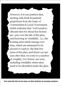
However their web site paints a confused picture.

click to enlarge

click to enlarge

On it they talk about a need to build 830 additional homes per year. That amounts to 16,600 additional houses during the next 20 years, and means the City would expand in size by 21% by 2035. Over 50% of the new homes would be likely to be occupied by inward migrants.

It appears that some Councillors have misunderstood the latest ONS population projections.

The latest figures say that York would have a natural population growth of 19,000 people between 2014 and 2030. This generates a demand for 540 extra homes each year.  

Anything above that figure caters for (in many peoples view unsustainable) economic growth

So it looks like the Tories are now also planning a “Big City” growth plan. Inevitably this would mean building on large parts of the Green Belt.

NB Over 50% of new planning permissions are currently being given for “windfall sites” All are “brownfield”

On average, over the last three years, 382 new homes per year have been built in York

Significant planning decision for York Green Belt

Brecks Lane, Strensall  planning application turned down by Secretary of State

click to download full decision

click to download full decision

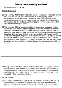
A proposal to build 102 houses on land next to Brecks Lane in Strensall has been turned down by the Secretary of State,

He “called in” the application after 9 Labour Councillors outvoted 7 Opposition Councillors to approve it at a local Planning committee meeting held on 24th February 2014. At that time the Council still had an overall Labour majority under the leadership of Cllr Alexander.

The Minister said that the refusal was because the site was located in the Green Belt.

This has a major significance for other peripheral sites around the City which were to be taken out of he Green Belt under Labours “Big City” expansion plans.

Now the draft Local Plan – rejected by the Council in October – has received a further blow.

It is good news for threatened sites in Woodthorpe, Foxwood Lane and between Acomb and the A1237, as all are in the currently defined Green Belt

The full decision can be downloaded by clicking here

No decision will be taken on the Local Plan now until after the Council elections on May 7th.

There are around 5000 outstanding planning permissions for new homes outstanding in York. The majority are on “brownfield” previously developed.

Cllr Ann Reid the new Liberal Democrat chair of the Planning Committee commented;

Members of the City of York Council planning committee visit the land at Strensall where Linden Homes want to build 102 homes

Site inspection in 2014

“I am delighted that the Secretary of State has refused planning permission for this site. Crucially, the ruling completely undermines a number of claims made by the Labour Cabinet and further discredits their Draft Local Plan.

 “The ruling recognises that the land is in the Green Belt and development should therefore be blocked in order to protect York’s character and stop unrestricted urban sprawl. It shows that even without a Local Plan in place it will not be open-season for developers in York’s countryside.

 “Crucially, the ruling supports the view that preventing development on this site, and on other Green Belt sites, will encourage development of brownfield land. This is why the Liberal Democrat Group has consistently advocated a brownfield first building policy.

 “The ruling says that only in very special circumstances should Green Belt land be developed. Labour have not demonstrated that those circumstances exist for this or other sites across York.

 “With so many undeveloped brownfield sites it is imperative that these are developed before a further attempt is made to bulldoze the Green Belt. Labour’s housing policy is once again in tatters and a radical rethink is needed.”

York population growth projections cut again

The latest population projections published by the government show a lower than expected increase in the City’s population in the period up to 2037.

Big City or Our City

The City’s population is now expected to grow from 195,000 in 2014,  to 214,000 in 2030 (the end date of the draft Local Plan).

This represents a growth of 19,000 producing an annual average increase of 1266.

This converts into a demand for an additional 575 homes per year (at an average occupancy level of 2.2 persons per home).

This is the figure that the Council used when it published its first Draft Local Plan in February 2011.

This is less than half the figure kicked about by Labour when they issued their projection figures in 2012.  Their “Big City” expansion plans produced outrage across the City and eventually led, in the autumn of last year, to the draft Local Plan being rejected by the newly balanced Council.

The City would be able to identify sites for 600 homes each year on land which already has planning permission and/or which is brownfield (previously developed) land.

There is no justification for building on Green Belt land.

It is unlikely now that a new Draft Local Plan will be agreed before the Council elections take place on May 7th.